30-05-2025

If you have an Android device, it’s likely that you’ve come to rely on Google Maps to get around wherever you go. But does Google Maps work in Iceland? The short answer is yes, you can use Google Maps for your Iceland trip, but there are some things you need to know before you rely on this app blindly and head off with your rental car in Iceland.
Google Maps is a useful tool to use during your self-driving trip in Iceland, especially if you don’t have a GPS unit. However, you will need to know a few things to help you use the app correctly and ensure you don’t find yourself in a location you didn’t intend to go.
Google Maps can be reliable in many destinations, but in Iceland, you will need to use it carefully. There are stories of people who entered a location and ended up at a place with the same name in another part of the country. Google Maps sometimes sends drivers down roads that aren’t really roads, so use the app with caution. Overall, it can be a reliable tool, especially when combined with Icelandic sources.

When driving the Ring Road and other major roads in Iceland, you can generally rely on Google Maps to work well to get you from one place to another. The major attractions are also easy to find using these maps. It’s usually the more obscure places that can be difficult to find with Google Maps. You will also need to be cautious of places with the same or similar names and ensure you are heading to the correct location.
While Google Maps is usually accurate for the main roads and attractions in Iceland, driving on the F-roads into the highlands is more likely to fail with Google Maps. The location names in the highlands may not show up in the app, making it more challenging to plan your route. There is no Street View in the highlands, and many roads aren’t monitored with real-time data available.
Another issue with using Google Maps in the highlands is the lack of a cell or Internet signal. However, you can get around this issue by downloading your maps before you head out on the F-roads. Doing so will ensure you have accurate navigation without worrying about whether you have a connection on your smartphone.
Finally, Google Maps doesn’t know which type of vehicle you are driving. Therefore, when it calculates the shortest distance between two locations, it may guide you down an F-road that your vehicle isn’t allowed to drive.

When you use Google Maps, you may notice the route is color-coded based on traffic conditions. However, it won’t show you what the road conditions are, even in adverse weather conditions. For this reason, you can’t rely solely on Google Maps to get around in Iceland.
You should always double-check your route on umferdin.is to get real-time conditions before starting your journey. This website is updated in real-time and will let you know about the conditions on the road. You can also see traffic numbers and webcams to help you make an informed decision before you start driving.
One of the biggest concerns with using Google Maps to guide you on your trip is worrying about not having Internet. While you can use your mobile plan, get a local SIM, or rent a Wi-Fi box, you can still find areas without a connection. In these situations, downloading offline maps is your best option.
To download offline maps from Google Maps to cover your Iceland trip, you should first type “Iceland” into the search bar. When the map shows up, click in the information box at the bottom of the screen, tap the “more” button, and choose “download map.” You can then drag and zoom to capture the areas you want for your trip. Once you have highlighted the desired area, tap “Download.”

For the most part, offline Iceland Google Maps will display the same roads that are visible when using the online version. However, you must make sure you keep the maps updated when you are connected to the Internet to avoid problems during your drive.
In addition, it’s beneficial to know what offline Google Maps don’t cover. While you can see basic navigation and points of interest, you won’t get real-time traffic or terrain data. F-roads and other remote trails won’t have much coverage, just like in the online version. Finally, you must be sure you can keep your phone charged with a car charger or power bank.
Google Maps is one of the top options visitors consider before their trip, but it isn’t the only option. In some situations, it may be best to choose something else based on the technology you have or the functions you need. The following are some of your options for your Iceland trip.
Google Maps is the best option for driving in Reykjavík, around the Ring Road, and to major tourist sites. You can use it to search for places, restaurants, and gas stations along your route, along with points of interest. The offline maps are also useful. However, Google Maps struggles in the highlands and may not offer appropriate routes based on your vehicle type.
Waze is another popular navigation app that works well in Iceland. With user-generated real-time updates, you can stay on top of hazards and speed cameras. However, you will need a consistent connection to use Waze as there are no offline maps available. The app also doesn’t address road closures or consider seasonal access.

Maps.me is another alternative to Google Maps. This app is fully offline and provides detailed information on trails, camping areas, and points of interest. This app is updated frequently by travelers. Unfortunately, Maps.me offers only basic driving directions and can be buggy or outdated at times, with a cluttered UI.
Finally, a Garmin GPS can be an excellent alternative. This device operates independently of a mobile signal and provides you with reliable directions. You will get turn-by-turn navigation assistance, even without an Internet connection. However, you will need to be sure you have the Iceland maps downloaded before you go.
If you want the best all-around experience from a navigation app, investing in a Garmin GPS or a similar unit can be the ideal solution. For those who will drive the main routes, Google Maps works quite well, especially if you want offline options. Waze is better for identifying speed cameras and other hazards, while Maps.me is a better option for hiking trips.
Does Google Maps work in Iceland? While it works reasonably well, there are some mistakes you should avoid to ensure you get the best experience. Here’s what you need to know to guarantee Google Maps will get you where you want to go.

Depending on your settings, Google Maps generally provides the shortest route from point A to point B. It doesn’t pay attention to what kind of roads they are, and it doesn’t know what vehicle you drive. Therefore, you must double-check your route to ensure it doesn’t include F-roads, especially in the winter or if you don’t have a vehicle that can drive them.
The last thing you want to do is get partway through your journey, only to find that you must turn around because you can’t continue further. Double-checking your route first will avoid this hassle and save you time in the long run.
The Ring Road has many offshoots that lead into private farms, but Google Maps can’t always tell the difference. In some situations, it may lead you onto private roads where you shouldn’t be driving. The best way to avoid this is to check the satellite view before taking a route. You can also cross-check the route with the road conditions website or a paper map.
As you drive, if you notice the road you are meant to turn onto isn’t marked with a road number, find a safe place to pull aside to check the map again. Chances are, this is a private road, so you should follow an alternative route.
It’s never a good idea to rely blindly on Google Maps without double-checking with local information. However, doing so in the winter is even more crucial. While Google Maps will usually indicate when a road is closed to traffic, it doesn’t always work so well in Iceland. Road conditions can change quickly, and Google may not update in time. Always compare your route with current road conditions.

As you prepare your itinerary and route using Google Maps, the following tips will ensure you get the best experience without worrying about whether you will reach your destinations. Self-driving in Iceland requires more than just knowing where you’re going. You will need to combine your mapped route with other aspects of driving safely.
Before you start your journey each day, you should check the current weather and road conditions. The weather in Iceland can change quickly, especially in the winter, so it’s best to re-check these websites after each stop. Taking this important step will keep you safer on the road and allow you to change your travel plans when necessary.
As you follow your route, it’s up to you to be aware of the speed limits and what various road signs mean. Speed limits in Iceland are generally 90 km/h between towns, 80 km/h on gravel roads, and 30 or 50 km/h within town limits. Many road signs are universal, allowing you to easily understand them. However, if you find one you don’t understand, search for it online to ensure you follow all driving rules.

As long as you have an Internet connection on your smartphone, you can easily use Google Maps to find gas stations, rest stops, and points of interest along your route. Simply search for what you need on your map. Google will identify the closest locations and make recommendations based on where you are.
Rest stops can be more difficult to find on Google Maps. If you’re looking for a place to pull off to stretch your legs or eat some food, watch for signs that indicate a picnic area, a sightseeing spot, or a parking lot. Never pull over just anywhere along the road, as Icelandic roads don’t have a shoulder and are narrow.
Does Google Maps work in Iceland? Overall, Google Maps can work for you in Iceland as long as you take precautions and check your route. It’s never a good idea to blindly trust what Google Maps tells you, especially in Iceland. Visitors have found themselves on the wrong side of the island because of multiple locations with the same name.
When you rent a car in Iceland, it’s best to use Google Maps in conjunction with other sources, such as a Garmin GPS, Waze, Maps.me, and Iceland’s website for road conditions. With the right planning and careful attention, you can rest assured you will get where you want to go.
Ready to explore Iceland? Book your rental car today.
Book now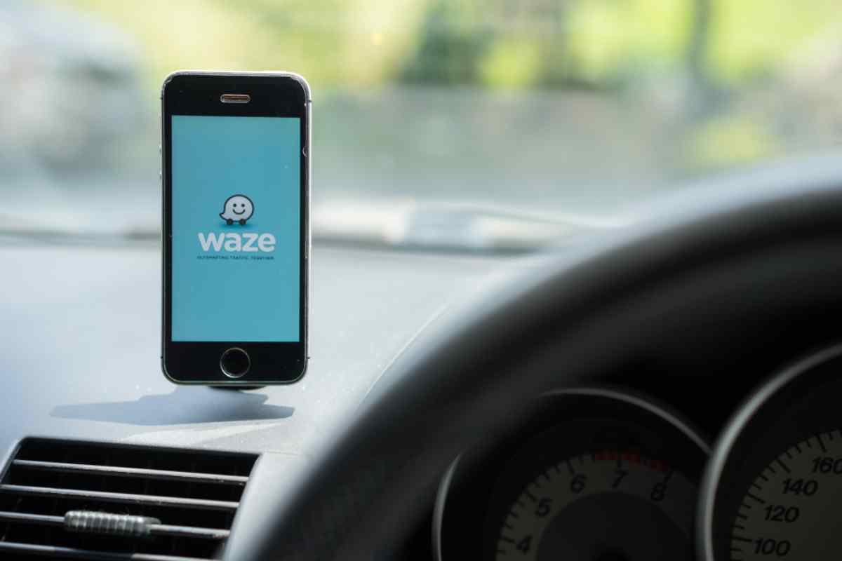
Wondering if Waze works in Iceland? Discover where it’s helpful, where it falls short, and essential tips for navigating...
Read More
Driving in Iceland is epic, but it’s easy to mess up. From sneaky road rules to rental car tips, here’s how to stay safe...
Read More
Driving in Iceland? Learn about speed cameras, fines, and rules to avoid costly mistakes while renting a car. Stay safe ...
Read More